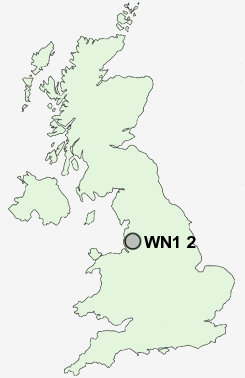
Postcode : WN1 2, Wigan, Greater Manchester
Postcodes in the WN1 2 district. Covering areas such as Adlington Park, Marylebone, Whitley, Red Rock, Winstanleys and Wigan in Lancashire, Greater Manchester.
Postcode Area WN : Wigan
WN1 Postcode Sectors
WN1 2 Nearby Postcode Districts
BL0 BL1 BL2 BL3 BL4 BL5 BL6 BL7 BL8 BL9 L23 L29 L30 L31 L33 L39 L40 M25 M26 M27 M28 M29 M3 M30 M38 M4 M45 M46 M6 M7 M8 PR6 PR7 PR8 PR9 WN1 WN2 WN3 WN4 WN5 WN6 WN7 WN8
Stations near to WN1 2
Wigan Wallgate Rail Station about 2.47 miles away.Adlington (Lancs) Rail Station about 2.49 miles away.
Wigan North Western Rail Station about 2.55 miles away.
Ince (Manchester) Rail Station about 2.95 miles away.
WN1 2 Schools
Woodfield Primary SchoolSt David Haigh and Aspull CofE Primary School
Wood Fold Primary School
Beech Hill Community Primary School
Canon Sharples Church of England Primary School and Nursery
UK Search
Antique Furniture
1000s of pieces of Antique Furniture for sale from British antique dealers.