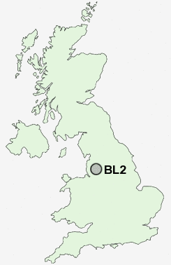
Postcode : BL2, Bolton, Greater Manchester
Postcodes in the BL2 sector. Covering areas such as Halfway Houses, Harwood, Side of the Moor, Darcy Lever, Mill Hill, Bradshaw, Harwood Lee, Breightmet, Bromley Cross, Ainsworth, Tonge Fold, Bradley Fold, Firwood Fold, Tonge Moor and Bolton in Greater Manchester.
Postcode Area BL : Bolton
BL2 Postcode Sectors
BL2 4 Bromley Cross, Firwood Fold, Harwood, Harwood Lee, Side of the Moor
BL2 1 Darcy Lever
BL2 2 Mill Hill, Tonge Fold, Tonge Moor
BL2 1 Darcy Lever
BL2 2 Mill Hill, Tonge Fold, Tonge Moor
BL2 Nearby Postcode Districts
BL0 BL1 BL2 BL3 BL4 BL5 BL6 BL7 BL8 BL9 M24 M25 M26 M27 M28 M29 M35 M38 M40 M45 M46 M6 M7 M8 M9 OL1 OL10 OL11 OL12 OL15 OL16 OL2 OL3 OL4 OL5 OL6 OL7 OL8 OL9 PR26 PR6 PR7 WN1 WN2 WN3 WN4 WN5 WN6 WN7 WN8
Stations near to BL2
Hall i' th' Wood Rail Station about 0.99 miles away.Bolton Rail Station about 1.59 miles away.
Bromley Cross Rail Station about 1.91 miles away.
Moses Gate Rail Station about 2.23 miles away.
Farnworth Rail Station about 2.64 miles away.
Kearsley Rail Station about 3.14 miles away.
BL2 Schools
Withins SchoolLeverhulme Community Primary School
Castle Hill Primary School
The Valley Community Primary School
Sharples School
Little Lever School Specialist Language College
UK Search
Antique Clocks
Browse Antique Clocks for sale from British antique dealers.