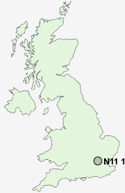
Postcode : N11 1, Greater London, Enfield, Greater London
Postcodes in the N11 1 district. Covering areas such as Brunswick Park, Friern Barnet, New Southgate and Greater London in Barnet, Greater London, Enfield, Greater London.
Postcode Area N : London North
N11 Postcode Sectors
N11 1 Nearby Postcode Districts
CM16 E1 E10 E11 E12 E13 E15 E17 E18 E2 E3 E4 E5 E6 E7 E8 E9 EC1 EC1A EC1M EC1N EC1R EC1V EC1Y EC2 EC2A EC2M EC2R EC2Y EC3P EN1 EN2 EN3 EN4 EN5 EN6 EN7 EN8 EN9 HA0 HA1 HA2 HA3 HA4 HA5 HA6 HA7 HA8 HA9 IG1 IG10 IG11 IG2 IG3 IG4 IG5 IG6 IG7 IG8 IG9 N1 N10 N11 N12 N13 N14 N15 N16 N17 N18 N19 N2 N20 N21 N22 N3 N4 N5 N6 N7 N8 N9 NW1 NW10 NW11 NW2 NW3 NW4 NW5 NW6 NW7 NW8 NW9 RM1 RM10 RM11 RM12 RM13 RM14 RM2 RM3 RM4 RM5 RM6 RM7 RM8 RM9 SL0 UB10 UB11 UB4 UB5 UB6 UB8 UB9 W10 W1G W1H W1M W1T W1U W1W W9 WC1 WC1A WC1B WC1E WC1H WC1N WC1R WC1V WC1X WD1 WD17 WD18 WD19 WD2 WD23 WD24 WD25 WD3 WD4 WD5 WD6 WD7
Stations near to N11 1
Bowes Park Rail Station about 0.79 miles away.Alexandra Palace Rail Station about 1.36 miles away.
Grange Park Rail Station about 2.31 miles away.
Harringay Rail Station about 2.92 miles away.
Harringay Green Lanes Rail Station about 3.06 miles away.
Enfield Chase Rail Station about 3.07 miles away.
Crouch Hill Rail Station about 3.18 miles away.
Gordon Hill Rail Station about 3.59 miles away.
N11 1 Schools
Bounds Green Infant SchoolBounds Green Junior School
Woodside High School, a Business & Enterprise Specialist School
Campsbourne Infant School
UK Search
Antique Furniture
1000s of pieces of Antique Furniture for sale from British antique dealers.