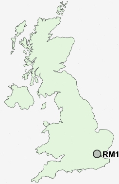
Postcode : RM1, Greater London, London
Postcodes in the RM1 sector. Covering areas such as Tilbury, North Ockendon, Orsett, Lakeside, Coldharbour, Elm Park, Little Thurrock, South Ockendon, Emerson Park, South Hornchurch, East Tilbury, Rainham, North Stifford, Hacton, Orsett Heath, Thurrock and Greater London in Essex, Havering, Greater London, Kent.
Postcode Area RM : Romford
RM1 Postcode Sectors
RM1 Nearby Postcode Districts
CM11 CM12 CM13 CM14 CM15 CM4 DA17 DA18 E1 E10 E11 E12 E13 E14 E15 E16 E17 E18 E1W E2 E3 E4 E5 E6 E7 E8 E9 EC1 EC1A EC1M EC1N EC1R EC1V EC1Y EC2 EC2A EC2M EC2N EC2R EC2V EC2Y EC3 EC3A EC3M EC3N EC3P EC3R EC3V EC4 EC4A EC4M EC4N EC4R EC4V EC4Y EN1 EN2 EN3 EN4 EN5 IG1 IG10 IG11 IG2 IG3 IG4 IG5 IG6 IG7 IG8 IG9 N1 N10 N11 N12 N13 N14 N15 N16 N17 N18 N19 N2 N20 N21 N22 N3 N4 N5 N6 N7 N8 N9 NW1 NW11 NW3 NW5 NW6 NW8 RM1 RM10 RM11 RM12 RM13 RM14 RM15 RM16 RM19 RM2 RM3 RM4 RM5 RM6 RM7 RM8 RM9 SE1 SE10 SE11 SE16 SE17 SE18 SE2 SE28 SE7 SE8 SS11 SS12 SS13 SS14 SS15 SS16 SS17 SS7 SW1 SW10 SW1A SW1E SW1H SW1P SW1V SW1W SW1X SW1Y SW3 SW5 SW7 W1 W10 W11 W14 W1B W1C W1D W1F W1G W1H W1J W1K W1M W1S W1T W1U W1W W2 W8 W9 WC1 WC1A WC1B WC1E WC1H WC1N WC1R WC1V WC1X WC2 WC2A WC2B WC2E WC2H WC2N WC2R
Stations near to RM1
Romford Rail Station about 0.43 miles away.Gidea Park Rail Station about 0.95 miles away.
Emerson Park Rail Station about 1.77 miles away.
Harold Wood Rail Station about 2.26 miles away.
RM1 Schools
Marshalls Park SchoolCrowlands Junior School
Crowlands Infant School
The Royal Liberty School
Crownfield Junior School
Crownfield Infant School
Bower Park School
Clockhouse Primary School
The Albany, A Business and Enterprise College
UK Search
Antique Furniture
1000s of pieces of Antique Furniture for sale from British antique dealers.