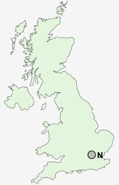
Postcode area N, London North
N Postcode Districts
N1 N10 N11 N12 N13 N14 N15 N16 N17 N18 N19 N2 N20 N21 N22 N3 N4 N5 N6 N7 N8 N9 NE1 NE10 NE11 NE12 NE13 NE15 NE16 NE17 NE18 NE19 NE2 NE20 NE21 NE22 NE23 NE24 NE25 NE26 NE27 NE28 NE29 NE3 NE30 NE31 NE32 NE33 NE34 NE35 NE36 NE37 NE38 NE39 NE4 NE40 NE41 NE42 NE43 NE44 NE45 NE46 NE47 NE48 NE49 NE5 NE6 NE61 NE62 NE63 NE64 NE65 NE66 NE67 NE68 NE69 NE7 NE70 NE71 NE8 NE9 NE99 NG1 NG10 NG11 NG12 NG13 NG14 NG15 NG16 NG17 NG18 NG19 NG2 NG20 NG21 NG22 NG23 NG24 NG25 NG3 NG31 NG32 NG33 NG34 NG4 NG5 NG6 NG7 NG8 NG9 NN1 NN10 NN11 NN12 NN13 NN14 NN15 NN16 NN17 NN18 NN2 NN29 NN3 NN4 NN5 NN6 NN7 NN8 NN9 NP10 NP11 NP12 NP13 NP15 NP16 NP18 NP19 NP20 NP22 NP23 NP24 NP25 NP26 NP4 NP44 NP7 NP8 NR1 NR10 NR11 NR12 NR13 NR14 NR15 NR16 NR17 NR18 NR19 NR2 NR20 NR21 NR22 NR23 NR24 NR25 NR26 NR27 NR28 NR29 NR3 NR30 NR31 NR32 NR33 NR34 NR35 NR4 NR5 NR6 NR7 NR8 NR9 NW1 NW10 NW11 NW2 NW3 NW4 NW5 NW6 NW7 NW8 NW9
Postcode Area N : London North
Stations near to N
Hendon Rail Station about 0.78 miles away.Mill Hill Broadway Rail Station about 1.88 miles away.
Wembley Stadium Rail Station about 2.57 miles away.
Cricklewood Rail Station about 2.6 miles away.
North Wembley Rail Station about 2.69 miles away.
Stonebridge Park Rail Station about 3.04 miles away.
Harlesden Rail Station about 3.44 miles away.
Brondesbury Park Rail Station about 3.65 miles away.
N Schools
Roe Green Infant SchoolRoe Green Junior School
Stag Lane Junior School
Stag Lane Infant and Nursery School
Woodcroft Primary School
Wykeham Primary School
Canons High School
Camrose Primary With Nursery