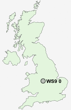
Postcode : WS9 0, Walsall, Staffordshire
Postcodes in the WS9 0 district. Covering areas such as Barr Common, Mill Green, Hardwick, Bourne Vale and Walsall in West Midlands, Staffordshire.
Postcode Area WS : Walssal
WS9 Postcode Sectors
WS9 8 Aldridge, Daw End, Leighswood, Stubber's Green, Vigo
WS9 0 Barr Common, Bourne Vale, Hardwick, Mill Green
WS9 0 Barr Common, Bourne Vale, Hardwick, Mill Green
WS9 0 Nearby Postcode Districts
B20 B23 B24 B35 B42 B43 B44 B70 B71 B72 B73 B74 B75 B76 B77 B78 B79 CV10 CV9 DY1 DY3 DY4 WS1 WS10 WS11 WS12 WS13 WS14 WS2 WS3 WS4 WS5 WS6 WS7 WS8 WS9 WV1 WV10 WV11 WV12 WV13 WV14 WV2 WV3 WV4 WV5 WV6 WV7 WV8 WV9
Stations near to WS9 0
Blake Street Rail Station about 1.97 miles away.Shenstone Rail Station about 2.75 miles away.
WS9 0 Schools
Leighswood SchoolLittle Aston Primary School
St Francis of Assisi Catholic Technology College
Castlefort Junior Mixed and Infant School
Whetstone Field Primary School
Aldridge School - A Science College
Four Oaks Primary School
UK Search
Antique Furniture
1000s of pieces of Antique Furniture for sale from British antique dealers.