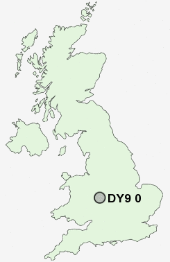
Postcode : DY9 0, Dudley, Worcestershire
Postcodes in the DY9 0 district. Covering areas such as Belbroughton, Lower Clent, Broome, Hagley, Hackman's Gate, Pedmore, Drayton, Broom Hill, Dordale, West Hagley and Dudley in Worcestershire, West Midlands.
Postcode Area DY : Dudley
DY9 Postcode Sectors
DY9 0 Belbroughton, Broom Hill, Broome, Dordale, Drayton
DY9 9 Bell End, Bell Heath, Clent, Hartle, Holy Cross
DY9 9 Bell End, Bell Heath, Clent, Hartle, Holy Cross
DY9 0 Nearby Postcode Districts
B1 B10 B11 B12 B13 B14 B15 B16 B17 B18 B19 B2 B20 B21 B24 B25 B26 B27 B28 B29 B3 B30 B31 B32 B33 B34 B35 B36 B38 B4 B45 B47 B48 B5 B6 B60 B61 B62 B63 B64 B65 B66 B67 B68 B69 B7 B70 B8 B9 B90 B91 B92 B93 B94 DY1 DY10 DY11 DY12 DY13 DY14 DY2 DY5 DY6 DY7 DY8 DY9 WV15 WV16
Stations near to DY9 0
Hagley Rail StationStourbridge Junction Rail Station about 1.76 miles away.
Stourbridge Junction Rail Station about 1.77 miles away.
Blakedown Rail Station about 1.87 miles away.
Stourbridge Town Rail Station about 2.29 miles away.
Lye (West Midlands) Rail Station about 2.8 miles away.
DY9 0 Schools
Hagley Primary SchoolHam Dingle Primary School
Hob Green Primary School
UK Search
Antique Jewellery
including Antique Engagement Rings for sale from UK Antique specialists.