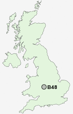
Postcode : B48, Worcestershire, Hereford And Worcester
Postcodes in the B48 sector. Covering areas such as Rowney Green, Withybed Green, Cobley Hill, Alvechurch, Arrowfield Top, Lea End, Weatheroak Hill and Worcestershire in Hereford And Worcester.
Postcode Area B : Birmingham
B48 Postcode Sectors
B48 Nearby Postcode Districts
B11 B13 B14 B27 B28 B29 B30 B31 B32 B38 B45 B47 B48 B60 B61 B63 B80 B90 B91 B92 B93 B94 B95 B97 B98 CV34 CV4 CV5 CV7 DY10 DY11 DY12 DY13 DY9 WR9
Stations near to B48
Alvechurch Rail Station about 1.03 miles away.Barnt Green Rail Station about 1.92 miles away.
Longbridge Rail Station about 3.19 miles away.
Redditch Rail Station about 3.36 miles away.
B48 Schools
Crown Meadow First School & NurseryAlvechurch CofE Middle School
UK Search
Antique Clocks
Browse Antique Clocks for sale from British antique dealers.