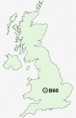
Postcode : B60, Worcestershire, Hereford And Worcester
Postcodes in the B60 sector. Covering areas such as Woodgate, Bellevue, Charford, Foster's Green, Hall Flat, Stoke Prior, Finstall, St Godwalds, Astwood, Burcot, Upper Gambolds, Sharpway Gate, Broad Green, Piper's Hill, Tutnall and Worcestershire in Hereford And Worcester.
Postcode Area B : Birmingham
B60 Postcode Sectors
B60 4 Astwood, Foster's Green, Hanbury, Harbours Hill, Lower Bentley
B60 3 Charford, St Godwalds, Stoke Pound, Upper Gambolds
B60 3 Charford, St Godwalds, Stoke Pound, Upper Gambolds
B60 Nearby Postcode Districts
B14 B30 B31 B38 B45 B47 B48 B60 B61 B80 B90 B91 B93 B94 B95 B96 B97 B98 DY10 DY11 DY12 DY13 WR6 WR9
Stations near to B60
Bromsgrove Rail Station about 0.27 miles away.B60 Schools
Aston Fields Middle SchoolFinstall First School
South Bromsgrove Community High School
Charford First School
North Bromsgrove High School
Millfields First School
Parkside Middle School
Meadows First School
Lickey End First School
UK Search
Antique Clocks
Browse Antique Clocks for sale from British antique dealers.