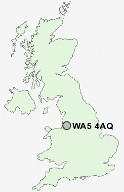
Postcode : WA5 4AQ, Burtonwood, Warrington, Cheshire
Green Lane, Burtonwood, Warrington.
WA5 4AQ close to Burtonwood and Collins Green.
Classification
WA5 4AQ : Rural residents / Rural tenants / Ageing rural flat tenants
Local Authority Warrington
Primary Care Trust Warrington
Ward Burtonwood and Winwick
Constituency Warrington North
Region North West
Country England
Postcode Area WA : Warrington
WA5 Postcode Sectors
WA5 4 Burtonwood, Collins Green
WA5 9 Callands, Dallam
WA5 2 Doe Green, Fiddler's Ferry, Penketh
WA5 1 Great Sankey, Hood Manor, Sankey Bridges
WA5 3 Lingley Green, Lingley Mere
WA5 4AQ Nearby Postcode Districts
CH41 CH42 CH44 CH45 CH63 L1 L10 L11 L12 L13 L14 L15 L16 L17 L18 L19 L2 L20 L21 L22 L23 L24 L25 L26 L27 L28 L29 L3 L30 L31 L32 L33 L34 L35 L36 L38 L4 L5 L6 L69 L7 L70 L8 L9 M16 M17 M21 M22 M23 M25 M27 M28 M29 M30 M31 M32 M33 M38 M41 M44 M46 M5 M6 M7 M90 WA1 WA10 WA11 WA12 WA13 WA14 WA15 WA2 WA3 WA4 WA5 WA8 WA9 WN3 WN4 WN5 WN7
Stations near to WA5 4AQ
Earlestown Rail Station about 1.29 miles away.St Helens Junction Rail Station about 1.8 miles away.
Newton-le-Willows Rail Station about 2.12 miles away.
Sankey for Penketh Rail Station about 3.05 miles away.
WA5 4AQ Schools
Burtonwood Community Primary SchoolLyme Community Primary School
Broad Oak Community Primary School
Newton-le-Willows Primary School
UK Search
Antique Furniture
1000s of pieces of Antique Furniture for sale from British antique dealers.