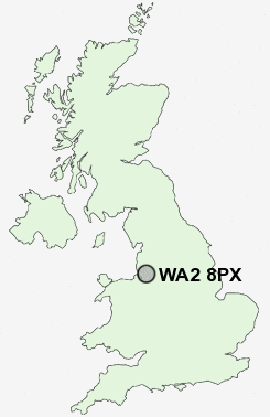
Postcode : WA2 8PX, Warrington, Cheshire
Long Lane, Warrington.
WA2 8PX close to Longford, Orford, Hulme, Winwick Quay and Blackwood.
Classification
WA2 8PX : Hard-pressed living / Industrious communities / Industrious transitions
Local Authority Warrington
Primary Care Trust Warrington
Ward Orford
Constituency Warrington North
Region North West
Country England
Postcode Area WA : Warrington
WA2 Postcode Sectors
WA2 0 Blackwood, Cinnamon Brow, Fearnhead, Houghton Green, Longbarn
WA2 8 Hermitage Green, Longford, Winwick
WA2 8 Hermitage Green, Longford, Winwick
WA2 8PX Nearby Postcode Districts
CH62 L1 L10 L11 L12 L13 L14 L15 L16 L17 L18 L19 L20 L24 L25 L26 L27 L28 L29 L3 L30 L32 L33 L34 L35 L36 L4 L5 L6 L69 L7 L70 L8 L9 M1 M12 M13 M14 M15 M16 M17 M19 M2 M20 M21 M22 M23 M3 M30 M31 M32 M33 M4 M40 M41 M44 M5 M6 M60 M7 M90 SK8 SK9 WA1 WA10 WA11 WA12 WA13 WA14 WA15 WA2 WA3 WA4 WA5 WA7 WA8 WA9 WN4 WN7
Stations near to WA2 8PX
Warrington Central Rail Station about 1.13 miles away.Padgate Rail Station about 1.3 miles away.
Warrington Bank Quay Rail Station about 1.62 miles away.
Newton-le-Willows Rail Station about 3.29 miles away.
Earlestown Rail Station about 3.61 miles away.
WA2 8PX Schools
William Beamont Community High SchoolMeadowside Community Primary and Nursery School
Beamont Community Primary School
Brook Acre Community Primary School
Dallam Community Primary School
Bewsey Lodge Primary School
Padgate Community High School
Callands Community Primary School
Westbrook Old Hall Primary School
Bruche Community Primary School
UK Search
Antique Furniture
1000s of pieces of Antique Furniture for sale from British antique dealers.