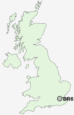
Postcode : BR6 9DJ, Orpington, Greater London, Bromley, Greater London
The Highway, Orpington.
BR6 9DJ close to Chelsfield and Goddington.
Classification
BR6 9DJ : Suburbanites / Semi-detached suburbia / Multi-ethnic suburbia
Local Authority Bromley
Primary Care Trust Bromley
Ward Chelsfield and Pratts Bottom
Constituency Orpington
Region London
Country England
Postcode Area BR : Bromley
BR6 Postcode Sectors
BR6 0 Broom Hill
BR6 9 Chelsfield, Goddington, Orpington
BR6 7 Downe, Farnborough, Luxted, Maypole, Pratt's Bottom
BR6 9 Chelsfield, Goddington, Orpington
BR6 7 Downe, Farnborough, Luxted, Maypole, Pratt's Bottom
BR6 9DJ Nearby Postcode Districts
BR1 BR2 BR3 BR4 BR5 BR6 BR7 BR8 CR0 CR2 CR3 CR4 CR5 CR6 CR7 CR8 DA1 DA10 DA11 DA12 DA13 DA14 DA15 DA2 DA3 DA4 DA5 DA6 DA9 KT17 KT18 KT19 KT20 KT3 KT4 KT5 ME1 ME16 ME19 ME2 ME20 ME6 SE12 SE13 SE19 SE20 SE21 SE22 SE23 SE24 SE25 SE26 SE27 SE6 SE9 SM1 SM2 SM3 SM4 SM5 SM6 SM7 SW12 SW15 SW16 SW17 SW18 SW19 SW2 SW20 TN13 TN14 TN15 TN16
Stations near to BR6 9DJ
Chelsfield Rail Station about 0.27 miles away.Knockholt Rail Station about 1.3 miles away.
Orpington Rail Station about 1.32 miles away.
St Mary Cray Rail Station about 2.41 miles away.
Petts Wood Rail Station about 2.53 miles away.
BR6 9DJ Schools
The Highway Primary SchoolChelsfield Primary School
Warren Road Primary School
Blenheim Primary School
Tubbenden Junior School
Tubbenden Infant School
Farnborough Primary School
Perry Hall Primary School
St Mary Cray Primary School
UK Search
Antique Clocks
Browse Antique Clocks for sale from British antique dealers.