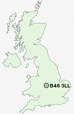
Postcode : B46 3LL, Cole End, Warwickshire
Wingfield Road, Coleshill, Birmingham.
B46 3LL close to Cole End, Coleshill and Duke End.
Classification
B46 3LL : Hard-pressed living / Hard pressed ageing workers / Ageing industrious workers
Local Authority North Warwickshire
Primary Care Trust Warwickshire
Ward Coleshill South
Constituency North Warwickshire
Region West Midlands
Country England
Postcode Area B : Birmingham
B46 Postcode Sectors
B46 1 Chattle Hill, Cole End, Coleshill, Gilson, Water Orton
B46 3LL Nearby Postcode Districts
B1 B10 B11 B12 B13 B14 B15 B16 B17 B18 B19 B2 B20 B21 B23 B24 B25 B26 B27 B28 B29 B3 B30 B31 B32 B33 B34 B35 B36 B37 B38 B4 B40 B42 B43 B44 B46 B5 B6 B62 B63 B64 B65 B66 B67 B68 B69 B7 B70 B71 B72 B73 B74 B75 B76 B8 B9 B90 B91 B92 CV1 CV10 CV11 CV12 CV2 CV4 CV5 CV6 CV7 CV9 DY1 DY2 DY4 LE10 WS1 WS10 WS2 WS5 WV13 WV14
Stations near to B46 3LL
Coleshill Parkway Rail Station about 1.53 miles away.Water Orton Rail Station about 2.19 miles away.
Marston Green Rail Station about 2.71 miles away.
Birmingham International Rail Station about 3.09 miles away.
B46 3LL Schools
Coleshill CofE Primary SchoolSt Edward's Catholic Primary School
The Coleshill School - a Maths and Computing College
High Meadow Infant School
Windy Arbor Primary School
Smith's Wood Sports College
The City Technology College
Kingfisher Primary School
Alcott Hall Junior and Infant School
Coleshill Heath School
UK Search
Antique Clocks
Browse Antique Clocks for sale from British antique dealers.