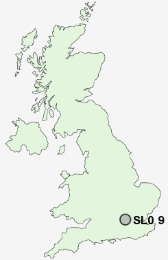
Postcode : SL0 9, Buckinghamshire
Postcodes in the SL0 9 district. Covering areas such as Richings Park, Thorney and Buckinghamshire.
Postcode Area SL : Slough
SL0 Postcode Sectors
SL0 9 Nearby Postcode Districts
EC1 EC1A EC1M EC1N EC1R EC1V EC2Y EC3P EC4 EC4A EC4M EC4V EC4Y HA0 HA1 HA2 HA3 HA4 HA5 HA9 KT1 KT2 N1 N10 N19 N2 N22 N3 N4 N5 N6 N7 N8 NW1 NW10 NW11 NW2 NW3 NW4 NW5 NW6 NW8 NW9 RG10 RG12 RG41 RG42 SE11 SE24 SE27 SL0 SL1 SL2 SL3 SL4 SL5 SL6 SL7 SL8 SL9 SW1 SW10 SW11 SW12 SW13 SW14 SW15 SW16 SW17 SW18 SW19 SW1A SW1E SW1H SW1P SW1V SW1W SW1X SW1Y SW2 SW20 SW3 SW4 SW5 SW6 SW7 SW8 SW9 TW1 TW10 TW11 TW12 TW13 TW14 TW15 TW16 TW18 TW19 TW2 TW20 TW3 TW4 TW5 TW6 TW7 TW8 TW9 UB1 UB10 UB11 UB2 UB3 UB4 UB5 UB6 UB7 UB8 UB9 W1 W10 W11 W12 W13 W14 W1B W1C W1D W1F W1G W1H W1J W1K W1M W1S W1T W1U W1W W2 W3 W4 W5 W6 W7 W8 W9 WC1 WC1A WC1B WC1E WC1H WC1N WC1R WC1V WC1X WC2 WC2A WC2B WC2E WC2H WC2N WC2R
Stations near to SL0 9
Iver Rail Station about 0.54 miles away.West Drayton Rail Station about 1.07 miles away.
Langley (Berks) Rail Station about 1.99 miles away.
Heathrow Airport Terminal 5 about 2.33 miles away.
Heathrow Terminal 5 Rail Station about 2.41 miles away.
Heathrow Terminals 1-3 Rail Station about 2.91 miles away.
Heathrow Airport Central Bus Stn (Rail-Air) about 2.96 miles away.
Heathrow Terminal 4 (Rail-Air) about 3.78 miles away.
SL0 9 Schools
Iver Village Infant SchoolWest Drayton Primary School
Rabbsfarm Primary School
The Iver Village Junior School
Parlaunt Park Primary School
Stockley Academy
Stockley Academy
UK Search
Antique Furniture
1000s of pieces of Antique Furniture for sale from British antique dealers.