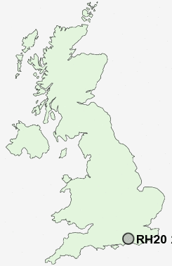
Postcode : RH20 2, West Sussex
Postcodes in the RH20 2 district. Covering areas such as West Chiltington Common, Pulborough, West Chiltington, Wiggonholt, Goose Green, Gay Street, Broomershill, Nutbourne, Marehill, Cross Gate, Smock Alley, Nutbourne Common, Greatham, Rackham and West Sussex.
Postcode Area RH : Redhill
RH20 Postcode Sectors
RH20 3 Abingworth, Ashington, Heath Common, Rock, Sullington Warren
RH20 1 Bedham, Bignor, Bury, Bury Hollow, Churchwood
RH20 1 Bedham, Bignor, Bury, Bury Hollow, Churchwood
RH20 2 Broomershill, Cross Gate, Gay Street, Goose Green, Greatham
RH20 4 Cootham, Storrington, Sullington, Washington
RH20 4 Cootham, Storrington, Sullington, Washington
RH20 2 Nearby Postcode Districts
BN1 BN18 BN41 BN44 BN45 BN5 BN6 GU28 GU29 PO18 RH13 RH14 RH15 RH16 RH17 RH20
Stations near to RH20 2
Pulborough Rail Station about 1.89 miles away.RH20 2 Schools
Arundale SchoolSt Mary's Church of England Primary School
Storrington Primary School
UK Search
Antique Furniture
1000s of pieces of Antique Furniture for sale from British antique dealers.