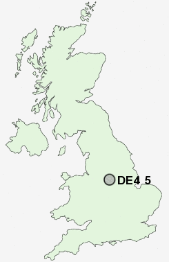
Postcode : DE4 5, Derbyshire
Postcodes in the DE4 5 district. Covering areas such as Starkholmes, Longway Bank, Upper Hackney, Tansley, Hearthstone, Holloway, Holestone, Matlock Cliff, Tansley Knoll, Farley, Wheatcroft, Crich, Lea, Whatstandwell, Crich Carr and Derbyshire.
Postcode Area DE : Derby
DE4 Postcode Sectors
DE4 4 Aldwark, Ashleyhay, Brassington, Carsington, Gorseybank
DE4 2 Beeley, Birchover, Bonsall, Brightgate, Calton Lees
DE4 2 Beeley, Birchover, Bonsall, Brightgate, Calton Lees
DE4 3 Bolehill, Cromford, Matlock, Matlock Bank, Matlock Bath
DE4 5 Crich, Crich Carr, Farley, Hearthstone, Holestone
DE4 5 Crich, Crich Carr, Farley, Hearthstone, Holestone
DE4 5 Nearby Postcode Districts
DE4 DE5 DE55 DE56 NG15 NG16 NG17 NG18 NG19 NG20 NG21 S42 S45
Stations near to DE4 5
Whatstandwell Rail Station about 2.5 miles away.DE4 5 Schools
Wessington Primary SchoolSouth Wingfield Primary School
UK Search
Antique Jewellery
including Antique Engagement Rings for sale from UK Antique specialists.