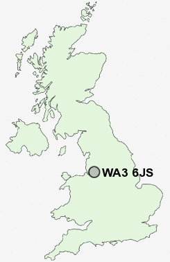
Postcode : WA3 6JS, Golborne, Warrington, Greater Manchester
Birch Road, Rixton, Warrington.
WA3 6JS close to Hollinfare, Hollins Green, Rixton and Glazebrook.
Classification
WA3 6JS : Rural residents / Rural tenants / Rural life
Local Authority Warrington
Primary Care Trust Warrington
Ward Rixton and Woolston
Constituency Warrington North
Region North West
Country England
Postcode Area WA : Warrington
WA3 Postcode Sectors
WA3 1 Aspull Common, Lane Head, Lowton Common, Lowton Heath, Lowton St Mary's
WA3 6 Birchwood, Gorse Covert, Hollinfare, Hollins Green, Oakwood
WA3 7 Croft, Kenyon, Locking Stumps, New Lane End
WA3 6 Birchwood, Gorse Covert, Hollinfare, Hollins Green, Oakwood
WA3 7 Croft, Kenyon, Locking Stumps, New Lane End
WA3 4 Culcheth, Little Town, Twiss Green
WA3 5 Fowley Common, Glazebrook, Glazebury
WA3 2 Golborne, Lowton
WA3 5 Fowley Common, Glazebrook, Glazebury
WA3 2 Golborne, Lowton
WA3 6JS Nearby Postcode Districts
L24 L26 L27 L34 L35 L36 M1 M11 M12 M13 M14 M15 M16 M17 M18 M19 M2 M20 M21 M22 M23 M27 M28 M29 M3 M30 M31 M32 M33 M34 M35 M4 M40 M41 M43 M44 M5 M6 M60 M7 M8 M90 OL6 OL7 SK1 SK12 SK16 SK2 SK3 SK4 SK5 SK6 SK7 SK8 SK9 WA1 WA10 WA11 WA12 WA13 WA14 WA15 WA2 WA3 WA4 WA5 WA7 WA8 WA9 WN4 WN7
Stations near to WA3 6JS
Glazebrook Rail Station about 0.91 miles away.Irlam Rail Station about 1.7 miles away.
WA3 6JS Schools
Hollins Green St Helen's CofE (Aided) Primary SchoolForest Gate Community Primary School
Our Lady of Lourdes Catholic Primary School
Broadoak School
Partington Primary School
Cadishead Primary School
Irlam and Cadishead College
UK Search
Antique Furniture
1000s of pieces of Antique Furniture for sale from British antique dealers.