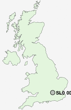
Postcode : SL0 0DT, Iver Heath, Buckinghamshire
Slough Road, Iver.
SL0 0DT close to Iver Heath, Shreding Green, Iver and Love Green.
Classification
SL0 0DT : Constrained city dwellers / White communities / Outer city hardship
Local Authority South Bucks
Primary Care Trust Buckinghamshire
Ward Iver Heath
Constituency Beaconsfield
Region South East
Country England
Postcode Area SL : Slough
SL0 Postcode Sectors
SL0 0DT Nearby Postcode Districts
HA0 HA1 HA2 HA3 HA4 HA5 HA6 HA7 HA8 HA9 HP10 HP11 HP12 HP13 HP9 N10 N11 N12 N14 N19 N2 N20 N3 N6 NW1 NW10 NW11 NW2 NW3 NW4 NW5 NW6 NW7 NW8 NW9 RG10 RG5 SL0 SL1 SL2 SL3 SL4 SL6 SL7 SL8 SL9 SW1 SW10 SW11 SW12 SW13 SW14 SW15 SW18 SW1A SW1E SW1H SW1P SW1V SW1W SW1X SW1Y SW3 SW4 SW5 SW6 SW7 SW8 TW1 TW10 TW13 TW14 TW19 TW2 TW3 TW4 TW5 TW6 TW7 TW8 TW9 UB1 UB10 UB11 UB2 UB3 UB4 UB5 UB6 UB7 UB8 UB9 W1 W10 W11 W12 W13 W14 W1B W1C W1D W1F W1G W1H W1J W1K W1M W1S W1T W1U W1W W2 W3 W4 W5 W6 W7 W8 W9 WC1 WC1A WC1B WC1E WC1H WC1N WC2 WC2B WC2E WC2H WC2N WD19
Stations near to SL0 0DT
Iver Rail Station about 2.01 miles away.Langley (Berks) Rail Station about 2.19 miles away.
West Drayton Rail Station about 2.73 miles away.
Denham Golf Club Rail Station about 3.04 miles away.
Denham Rail Station about 3.07 miles away.
SL0 0DT Schools
Iver Heath Infant School and NurseryIver Heath Junior School
The Iver Village Junior School
Iver Village Infant School
Whitehall Junior School
Whitehall Infant School
UK Search
Antique Furniture
1000s of pieces of Antique Furniture for sale from British antique dealers.