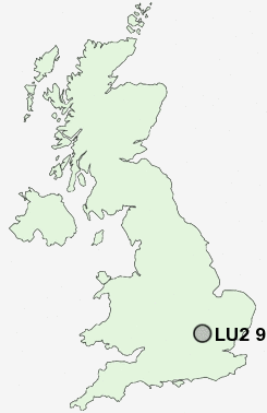
Postcode : LU2 9TB, Cockernhoe, Luton, Hertfordshire
Twyford Drive, Luton.
LU2 9TB close to Cockernhoe, Mangrove Green, Hart Hill and Wandon End.
Classification
LU2 9TB : Urbanites / Urban professionals and families / Multi-ethnic professionals with families
Local Authority Luton
Primary Care Trust Luton
Ward Wigmore
Constituency Luton South
Region Eastern
Country England
Postcode Area LU : Luton
LU2 Postcode Sectors
LU2 9TB Nearby Postcode Districts
AL5 AL6 AL7 AL8 HP22 HP23 LU1 LU2 LU3 LU4 LU5 LU6 LU7 SG1 SG12 SG14 SG2 SG3 SG4 SG5 SG6 SG9
Stations near to LU2 9TB
Luton Airport Parkway Rail Station about 1.49 miles away.Luton Rail Station about 1.73 miles away.
LU2 9TB Schools
Wigmore Primary SchoolSomeries Infant School
Someries Junior School
Ramridge Primary School
Putteridge High School
Putteridge Junior School
Putteridge Primary School
Stopsley Community Primary School
St Matthew's Primary School
Surrey Street Primary School
UK Search
Antique Jewellery
including Antique Engagement Rings for sale from UK Antique specialists.