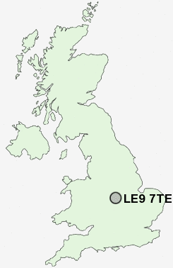
Postcode : LE9 7TE, Thurlaston, Leicestershire
Desford Road, Thurlaston, Leicester.
LE9 7TE close to Thurlaston and Normanton Turville.
Classification
LE9 7TE : Rural residents / Rural tenants / Rural white-collar workers
Local Authority Blaby
Primary Care Trust Leicestershire County and Rutland
Ward Normanton
Constituency South Leicestershire
Region East Midlands
Country England
Postcode Area LE : Leicester
LE9 Postcode Sectors
LE9 8 Barwell, Stapleton
LE9 9 Botcheston, Brascote, Desford, Hunt's Lane, Merry Lees
LE9 6 Broughton Astley, Primethorpe, Sutton in the Elms
LE9 1 Cosby
LE9 9 Botcheston, Brascote, Desford, Hunt's Lane, Merry Lees
LE9 6 Broughton Astley, Primethorpe, Sutton in the Elms
LE9 1 Cosby
LE9 3 Croft, Huncote, Potters Marston
LE9 7 Earl Shilton, Elmesthorpe, Kirkby Mallory, Normanton Turville, Peckleton
LE9 2 Kirby Fields, Kirby Muxloe, Newtown Unthank
LE9 4 Sapcote, Stoney Stanton
LE9 7 Earl Shilton, Elmesthorpe, Kirkby Mallory, Normanton Turville, Peckleton
LE9 2 Kirby Fields, Kirby Muxloe, Newtown Unthank
LE9 4 Sapcote, Stoney Stanton
LE9 7TE Nearby Postcode Districts
CV10 CV11 CV13 CV9 LE1 LE10 LE18 LE2 LE3 LE4 LE5 LE6 LE7 LE8 LE9
LE9 7TE Schools
Thurlaston Church of England Primary SchoolHuncote Community Primary School
UK Search
Antique Jewellery
including Antique Engagement Rings for sale from UK Antique specialists.