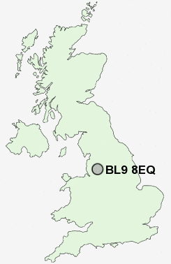
Postcode : BL9 8EQ, Bury, Greater Manchester
Hathaway Road, Bury.
BL9 8EQ close to Whitefield, Sunny Bank, Unsworth, Blackford Bridge, Hollins and Redvales.
Classification
BL9 8EQ : Suburbanites / Semi-detached suburbia / Multi-ethnic suburbia
Local Authority Bury
Primary Care Trust Bury
Ward Unsworth
Constituency Bury South
Region North West
Country England
Postcode Area BL : Bolton
BL9 Postcode Sectors
BL9 5 Baldingstone, Fernhill, Limefield, Summerseat, Walmersley
BL9 6 Birtle, Chesham, Free Town, Nangreaves
BL9 9 Blackford Bridge, Fishpool, Gigg, Redvales
BL9 6 Birtle, Chesham, Free Town, Nangreaves
BL9 9 Blackford Bridge, Fishpool, Gigg, Redvales
BL9 0 Bury
BL9 7 Fairfield, Heap Bridge, Jericho, Pimhole, Woodgate Hill
BL9 8 Hollins, Sunny Bank, Unsworth, Whitefield
BL9 7 Fairfield, Heap Bridge, Jericho, Pimhole, Woodgate Hill
BL9 8 Hollins, Sunny Bank, Unsworth, Whitefield
BL9 8EQ Nearby Postcode Districts
BL0 BL1 BL2 BL3 BL4 BL5 BL6 BL7 BL8 BL9 M1 M11 M12 M15 M17 M2 M24 M25 M26 M27 M28 M29 M3 M30 M35 M38 M4 M40 M43 M45 M46 M5 M6 M60 M7 M8 M9 OL1 OL10 OL11 OL12 OL15 OL16 OL2 OL3 OL4 OL5 OL6 OL7 OL8 OL9 PR7 SK15 SK16 WN1 WN2 WN3 WN4 WN5 WN6 WN7
Stations near to BL9 8EQ
Clifton (Manchester) Rail Station about 2.97 miles away.BL9 8EQ Schools
Sunny Bank Primary SchoolCastlebrook High School
Philips High School
Parrenthorn High School
The Derby High School
UK Search
Antique Clocks
Browse Antique Clocks for sale from British antique dealers.