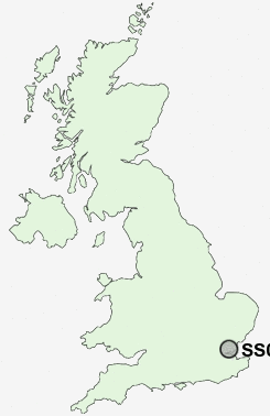
Postcode : SS0, Southend-on-Sea, Essex
Postcodes in the SS0 sector. Covering areas such as Chalkwell, Clifftown, Southend-on-Sea, Westcliff-on-Sea and Southend-on-Sea in Essex.
Postcode Area SS : Southend on Sea
SS0 Postcode Sectors
SS0 Nearby Postcode Districts
CM11 CM12 CM13 CM14 CM15 RM16 RM17 RM18 SS0 SS1 SS11 SS12 SS13 SS14 SS15 SS16 SS17 SS2 SS3 SS4 SS5 SS6 SS7 SS8 SS9
Stations near to SS0
Westcliff-on-Sea Rail Station about 0.6 miles away.Prittlewell Rail Station about 0.87 miles away.
Southend Victoria Rail Station about 0.89 miles away.
Chalkwell Rail Station about 1.05 miles away.
Southend Central Rail Station about 1.05 miles away.
Southend Airport Rail Station about 1.66 miles away.
Southend East Rail Station about 1.78 miles away.
Rochford Rail Station about 2.51 miles away.
SS0 Schools
Chase High SchoolBarons Court Primary School and Nursery
Earls Hall Primary School
Earls Hall Infant School
Chalkwell Hall Junior School
Darlinghurst Primary and Nursery School
Bournemouth Park Primary School
Blenheim Primary School
Leigh North Street Junior School
Leigh North Street Primary School
Temple Sutton Primary School
UK Search
Antique Furniture
1000s of pieces of Antique Furniture for sale from British antique dealers.