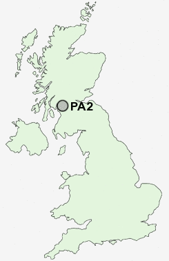
Postcode : PA2, Renfrewshire
Postcodes in the PA2 sector. Covering areas such as Sandbank, St Colmac, Bullwood, Whitehouse, Achanelid, Hunter's Quay, Glenburn, Ballimore, Grogport, Kilchenzie, Craigmore, Glenbranter, Conchra, Kerrycroy, Strone, Argyll and Bute and Renfrewshire in Argyll And Bute.
Postcode Area PA : Paisley
PA2 Postcode Sectors
PA2 Nearby Postcode Districts
G1 G11 G12 G13 G14 G15 G2 G20 G21 G22 G23 G3 G31 G32 G33 G34 G4 G40 G41 G42 G43 G44 G45 G46 G5 G51 G52 G53 G60 G61 G64 G69 G71 G72 G73 G74 G76 G77 G78 G81 KA14 KA15 KA25 ML3 PA1 PA10 PA11 PA12 PA13 PA14 PA2 PA3 PA4 PA5 PA6 PA7 PA8 PA9
Stations near to PA2
Paisley Canal Rail Station about 0.86 miles away.Paisley Gilmour Street Rail Station about 1.32 miles away.
Paisley St James Rail Station about 1.63 miles away.
Hawkhead Rail Station about 1.64 miles away.
Barrhead Rail Station about 2.25 miles away.
Neilston Rail Station about 3.19 miles away.
UK Search
Antique Furniture
1000s of pieces of Antique Furniture for sale from British antique dealers.