Postcode : WD25 9RH, Garston, Hertfordshire
Watford, Hertfordshire.
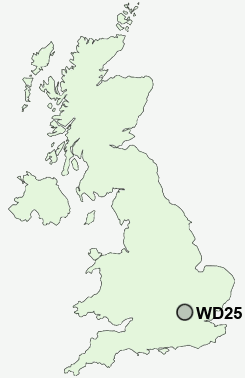
WD25 9RH close to Garston, Meriden and Kingswood.
Classification
WD25 9RH : Ethnicity central / Ethnic dynamics / Constrained neighbourhoods
Local Authority Watford
Primary Care Trust Hertfordshire
Ward Meriden
Constituency Watford
Region Eastern
Country England
Postcode Area WD : Watford
WD25 Postcode Sectors
WD25 9RH Nearby Postcode Districts
AL1 AL10 AL2 AL3 AL4 AL9 E17 E4 EN1 EN10 EN11 EN2 EN3 EN4 EN5 EN6 EN7 EN8 EN9 HA3 HA5 HA6 HA7 HA8 HP1 HP10 HP11 HP12 HP13 HP15 HP16 HP2 HP3 HP4 HP5 HP6 HP7 HP8 HP9 N10 N11 N12 N13 N14 N17 N18 N2 N20 N21 N22 N3 N8 N9 NW4 NW7 NW9 SL9 WD1 WD17 WD18 WD19 WD2 WD23 WD24 WD25 WD3 WD4 WD5 WD6 WD7
Stations near to WD25 9RH
Garston (Herts) Rail Station about 0.31 miles away.Watford Junction Rail Station about 1.38 miles away.
Bricket Wood Rail Station about 1.93 miles away.
Watford High Street Rail Station about 2.11 miles away.
Bushey Rail Station about 2.57 miles away.
Bushey Rail Station about 2.58 miles away.
How Wood (Herts) Rail Station about 2.98 miles away.
Park Street Rail Station about 3.52 miles away.
WD25 9RH Schools
Berrygrove Primary and Nursery SchoolKingsway Infants' School
Francis Combe School and Community College
Alban Wood Primary School and Nursery
Nascot Wood Infant and Nursery School
Nascot Wood Junior School
Mount Pleasant Lane Junior Mixed and Infant School and Nursery
Cassiobury Infant and Nursery School
UK Search
Antique Furniture
1000s of pieces of Antique Furniture for sale from British antique dealers.