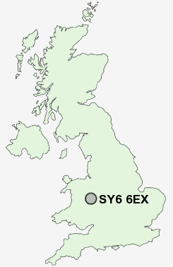
Postcode : SY6 6EX, Ashbrook, Shropshire
Shrewsbury Road, Church Stretton.
SY6 6EX close to Ashbrook, Church Stretton, Hazler and All Stretton.
Classification
SY6 6EX : Rural residents / Rural tenants / Ageing rural flat tenants
Local Authority Shropshire
Primary Care Trust Shropshire County
Ward Church Stretton and Craven Arms
Constituency Ludlow
Region West Midlands
Country England
Postcode Area SY : Shrewsbury
SY6 Postcode Sectors
SY6 6EX Nearby Postcode Districts
SY15 SY6 SY9 TF12 TF13 TF7 TF8 WV16
Stations near to SY6 6EX
Church Stretton Rail Station about 0.54 miles away.SY6 6EX Schools
Church Stretton SchoolSt Lawrence CofE Primary School
UK Search
Antique Furniture
1000s of pieces of Antique Furniture for sale from British antique dealers.