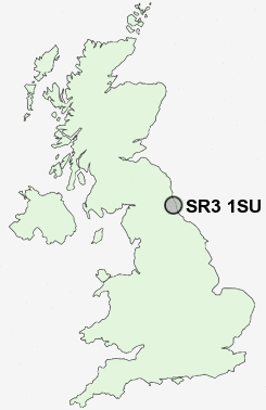
Postcode : SR3 1SU, Sunderland, Tyne And Wear
Tudor Grove, Sunderland.
SR3 1SU close to Tunstall, New Silksworth and Thorney Close.
Classification
SR3 1SU : Hard-pressed living / Industrious communities / Industrious hardship
Local Authority Sunderland
Primary Care Trust Sunderland Teaching
Ward Barnes
Constituency Sunderland Central
Region North East
Country England
Postcode Area SR : Sunderland
SR3 Postcode Sectors
SR3 1SU Nearby Postcode Districts
DH2 DH3 DH4 DH5 DH7 DH9 NE1 NE10 NE11 NE15 NE16 NE2 NE21 NE31 NE32 NE34 NE35 NE36 NE37 NE38 NE39 NE4 NE40 NE6 NE8 NE9 NE99 SR1 SR2 SR3 SR4 SR5 SR6 SR7 SR9
Stations near to SR3 1SU
Sunderland Rail Station about 1.56 miles away.St Peters Rail Station about 1.87 miles away.
Seaburn Rail Station about 2.98 miles away.
SR3 1SU Schools
Thorney Close Primary SchoolSandhill View School
New Silksworth Junior School
Hill View Infant School
Mill Hill Primary School
East Herrington Primary School
Hudson Road Primary School
Ryhope Junior School
Ryhope Infant School
UK Search
Antique Furniture
1000s of pieces of Antique Furniture for sale from British antique dealers.