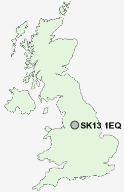
Postcode : SK13 1EQ, Padfield, Derbyshire
Rhodes Street, Padfield, Glossop.
SK13 1EQ close to Padfield, Tintwistle, Hadfield and Brookfield.
Classification
SK13 1EQ : Urbanites / Urban professionals and families / White professionals
Local Authority High Peak
Primary Care Trust Tameside and Glossop
Ward Padfield
Constituency High Peak
Region East Midlands
Country England
Postcode Area SK : Stockport
SK13 Postcode Sectors
SK13 2 Brookfield
SK13 6 Charlestown, Chunal, Gamesley, Hargate Hill, Hobroyd
SK13 5 Charlesworth, Chisworth, Higher Chisworth, Holehouse, Lee Head
SK13 1 Crowden, Deepclough, Hadfield, Padfield, Tintwistle
SK13 6 Charlestown, Chunal, Gamesley, Hargate Hill, Hobroyd
SK13 5 Charlesworth, Chisworth, Higher Chisworth, Holehouse, Lee Head
SK13 1 Crowden, Deepclough, Hadfield, Padfield, Tintwistle
SK13 1EQ Nearby Postcode Districts
M1 M11 M12 M13 M14 M15 M16 M17 M18 M19 M2 M20 M21 M22 M23 M24 M25 M26 M27 M3 M30 M32 M33 M34 M35 M4 M40 M43 M45 M5 M6 M60 M7 M8 M9 M90 OL1 OL3 OL4 OL5 OL6 OL7 OL8 OL9 S36 SK1 SK13 SK14 SK15 SK16 SK2 SK22 SK3 SK4 SK5 SK6 SK7 SK8 WA15
Stations near to SK13 1EQ
Hadfield Rail Station about 0.35 miles away.Dinting Rail Station about 1.08 miles away.
Glossop Rail Station about 1.32 miles away.
SK13 1EQ Schools
Padfield Community Primary SchoolHadfield Infant School
St Charles's Catholic Primary
Glossopdale School
Dinting Church of England Voluntary Aided Primary School
St Philip Howard Catholic School
Gamesley Community Primary School
Hollingworth Primary School
Longdendale High School
Saint Mary's Catholic Primary
Simmondley Primary School
St Margaret's Catholic Primary
UK Search
Antique Furniture
1000s of pieces of Antique Furniture for sale from British antique dealers.