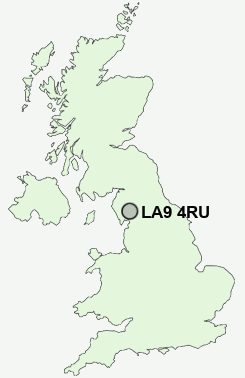
Postcode : LA9 4RU, Kentrigg, Cumbria
Kendal, Cumbria.
LA9 4RU close to Kentrigg, Mintsfeet and Kendal.
Classification
LA9 4RU : Rural residents / Rural tenants / Rural life
Local Authority South Lakeland
Primary Care Trust Cumbria Teaching
Ward Kendal Strickland
Constituency Westmorland and Lonsdale
Region North West
Country England
Postcode Area LA : Lancaster
LA9 Postcode Sectors
LA9 4RU Nearby Postcode Districts
Stations near to LA9 4RU
Kendal Rail Station about 0.39 miles away.Burneside (Cumbria) Rail Station about 1.55 miles away.
Oxenholme Lake District Rail Station about 2.35 miles away.
LA9 4RU Schools
St Thomas's CofE Primary SchoolStramongate Primary School
The Queen Katherine School
Ghyllside Primary School
Castle Park School
Vicarage Park CofE Primary School
Kirkbie Kendal School
Dean Gibson Catholic Primary School
Heron Hill Primary School
St Oswald's CofE Primary School
UK Search
Antique Jewellery
including Antique Engagement Rings for sale from UK Antique specialists.