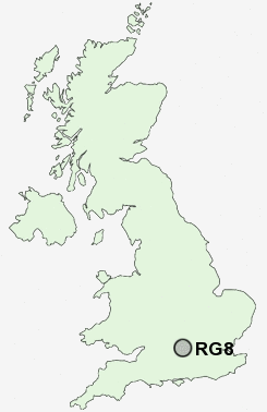
Postcode : RG8, Oxfordshire
Postcodes in the RG8 sector. Covering areas such as Checkendon, Westridge Green, Cray's Pond, Hungerford Green, Cleeve, Streatley, Sulham, Quick's Green, Stubbles, Collins End, Aldworth, Woodcote, Upper Basildon, Whitchurch Hill, Hill Bottom and Oxfordshire in Berkshire.
Postcode Area RG : Reading
RG8 Postcode Sectors
RG8 9 Aldworth, Four Points, Hungerford Green, Lower Basildon, Streatley
RG8 8 Ashampstead, Ashampstead Green, New Town, Quick's Green, Stubbles
RG8 8 Ashampstead, Ashampstead Green, New Town, Quick's Green, Stubbles
RG8 0 Checkendon, Cleeve, Exlade Street, Goring, Hook End
RG8 7 Cold Harbour, Collins End, Cray's Pond, Goring Heath, Hill Bottom
RG8 7 Cold Harbour, Collins End, Cray's Pond, Goring Heath, Hill Bottom
RG8 Nearby Postcode Districts
OX11 OX12 RG1 RG10 RG12 RG17 RG18 RG2 RG30 RG31 RG4 RG41 RG42 RG5 RG6 RG8 RG9 SL6 SL7 SL8
Stations near to RG8
Pangbourne Rail Station about 1.49 miles away.Goring & Streatley Rail Station about 1.66 miles away.
RG8 Schools
The Oratory Preparatory SchoolWhitchurch Primary School
UK Search
Antique Furniture
1000s of pieces of Antique Furniture for sale from British antique dealers.