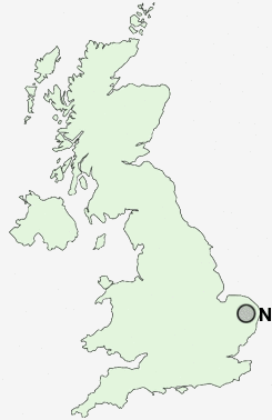
Postcode : NR15, Norfolk
Postcodes in the NR15 sector. Covering areas such as Sneath Common, Kirstead Green, Pottergate Street, Hawes' Green, Hempnall, Silver Green, Fritton, Aslacton, Shelton, Saxlingham Green, Mill Common, Lower Tasburgh, Great Moulton, Morningthorpe and Norfolk.
Postcode Area NR : Norwich
NR15 Postcode Sectors
NR15 Nearby Postcode Districts
IP20 NR14 NR15 NR16 NR17 NR18 NR34 NR35
NR15 Schools
Hempnall Primary SchoolPreston Church of England Voluntary Controlled Primary School
Saxlingham Nethergate CofE VC Primary School
UK Search
Antique Furniture
1000s of pieces of Antique Furniture for sale from British antique dealers.