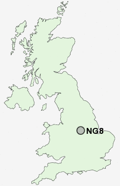
Postcode : NG8, Nottingham, Nottinghamshire
Postcodes in the NG8 sector. Covering areas such as Broxtowe, Wollaton, Whitemoor, Aspley, Bilborough, Strelley, Cinderhill and Nottingham in Nottinghamshire.
Postcode Area NG : Nottingham
NG8 Postcode Sectors
NG8 Nearby Postcode Districts
DE1 DE21 DE22 DE23 DE24 DE3 DE5 DE56 DE65 DE7 DE72 DE75 NG1 NG10 NG11 NG12 NG13 NG14 NG15 NG16 NG2 NG3 NG4 NG5 NG6 NG7 NG8 NG9
Stations near to NG8
Bulwell Rail Station about 2.55 miles away.Beeston Rail Station about 2.99 miles away.
NG8 Schools
Highwood Player Junior SchoolHighwood Player Infant and Nursery School
Brocklewood Junior School
Melbury Primary School
Ambleside Primary School
Middleton Primary and Nursery School
Fernwood Infant School
Southwold Primary School and Early Years' Centre
Seagrave Primary School
Whitemoor Primary and Nursery School
UK Search
Antique Furniture
1000s of pieces of Antique Furniture for sale from British antique dealers.