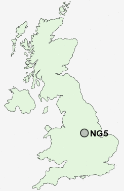
Postcode : NG5, Nottingham, Nottinghamshire
Postcodes in the NG5 sector. Covering areas such as Sherwood, Arnold, Woodthorpe, Carrington, Mapperley, Daybrook, Bestwood, Rise Park, Redhill, Top Valley and Nottingham in Nottinghamshire.
Postcode Area NG : Nottingham
NG5 Postcode Sectors
NG5 Nearby Postcode Districts
DE1 DE21 DE22 DE23 DE3 DE5 DE56 DE7 DE75 NG1 NG10 NG11 NG12 NG13 NG14 NG15 NG16 NG2 NG24 NG25 NG3 NG4 NG5 NG6 NG7 NG8 NG9
Stations near to NG5
Nottingham Rail Station about 3.45 miles away.NG5 Schools
Southglade Primary SchoolRobin Hood Primary School
Robert Mellors Primary and Nursery School
Henry Whipple Primary School
Walter Halls Primary and Early Years School
Mapperley Plains Primary and Nursery School
Westglade Primary School
Killisick Junior School
Pinewood Infant and Nursery School
UK Search
Antique Furniture
1000s of pieces of Antique Furniture for sale from British antique dealers.