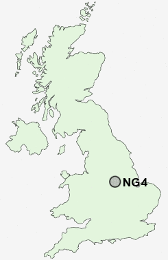
Postcode : NG4, Nottinghamshire
Postcodes in the NG4 sector. Covering areas such as Gedling, Netherfield, Lambley, Colwick, Carlton and Nottinghamshire.
Postcode Area NG : Nottingham
NG4 Postcode Sectors
NG4 Nearby Postcode Districts
DE1 DE21 DE24 DE5 DE56 DE7 DE72 DE75 NG1 NG10 NG11 NG12 NG13 NG14 NG15 NG16 NG2 NG24 NG3 NG4 NG5 NG6 NG7 NG8 NG9
Stations near to NG4
Carlton Rail Station about 0.46 miles away.Netherfield Rail Station about 0.65 miles away.
Burton Joyce Rail Station about 2.09 miles away.
Radcliffe (Notts) Rail Station about 2.5 miles away.
NG4 Schools
Priory Junior SchoolPhoenix Infant and Nursery School
Carlton Central Junior School
Central Infant and Nursery School
Haddon Primary and Nursery School
Parkdale Primary School
Standhill Infants' School
Porchester Junior School
Mapperley Plains Primary and Nursery School
UK Search
Antique Furniture
1000s of pieces of Antique Furniture for sale from British antique dealers.