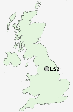
Postcode : LS2, Leeds, West Yorkshire
Postcodes in the LS2 sector. Covering areas such as Wood Row, Addingham, Chevin End, Hough Side, Lower Mickletown, Garforth, East Garforth, Hillfoot, Monk Fryston, Arthington, Stanningley, Meagill, Collingham, Micklefield, Bramham, Leeds, Bradford and North Yorkshire in West Yorkshire.
Postcode Area LS : Leeds
LS2 Postcode Sectors
LS2 Nearby Postcode Districts
BD1 BD10 BD11 BD12 BD13 BD14 BD15 BD16 BD17 BD18 BD19 BD2 BD21 BD3 BD4 BD5 BD6 BD7 BD8 BD9 HD6 HX1 HX2 HX3 LS1 LS10 LS11 LS12 LS13 LS14 LS15 LS16 LS17 LS18 LS19 LS2 LS20 LS24 LS25 LS26 LS27 LS28 LS3 LS4 LS5 LS6 LS7 LS8 LS9 WF10 WF11 WF15 WF16 WF17 WF3
Stations near to LS2
Leeds Rail Station about 0.39 miles away.Burley Park Rail Station about 1.54 miles away.
Headingley Rail Station about 2.32 miles away.
Cottingley Rail Station about 2.88 miles away.
LS2 Schools
Primrose High SchoolShakespeare Primary School
City of Leeds School
Mill Field Primary School
Greenmount Primary School
Woodlands Primary School
UK Search
Antique Jewellery
including Antique Engagement Rings for sale from UK Antique specialists.