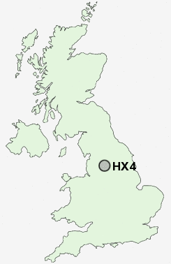
Postcode : HX4, Calderdale, West Yorkshire
Postcodes in the HX4 sector. Covering areas such as Sowood Green, Greetland Wall Nook, Outlane, Sowood, Lindwell, Outlane Moor, Holywell Green, West Vale, Krumlin, Broad Carr, Barkisland, Old Lindley, Penny Hill, Stainland and Calderdale in West Yorkshire.
Postcode Area HX : Halifax
HX4 Postcode Sectors
HX4 0 Barkisland, Bottomley, Krumlin
HX4 9 Broad Carr, Holywell Green, Jagger Green, Old Lindley, Outlane
HX4 9 Broad Carr, Holywell Green, Jagger Green, Old Lindley, Outlane
HX4 Nearby Postcode Districts
BD11 BD12 BD19 BD4 BD5 BD6 HD1 HD2 HD3 HD4 HD5 HD6 HD7 HD8 HD9 HX1 HX2 HX3 HX4 HX5 HX6 HX7 LS10 LS11 LS27 OL10 OL11 OL12 OL13 OL14 OL15 OL16 WF1 WF12 WF13 WF14 WF15 WF16 WF17 WF2 WF3 WF4 WF5
Stations near to HX4
Sowerby Bridge Rail Station about 2.28 miles away.Halifax Rail Station about 3.09 miles away.
HX4 Schools
Holywell Green Primary SchoolBowling Green Primary School
Greetland Primary School
Moorlands Primary School
Park Lane Learning Trust
UK Search
Antique Jewellery
including Antique Engagement Rings for sale from UK Antique specialists.