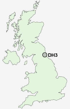
Postcode : DH3, County Durham
Postcodes in the DH3 sector. Covering areas such as Chester-Le-Street, Barley Mow, Birtley, Great Lumley and County Durham in Tyne and Wear.
Postcode Area DH : Durham
DH3 Postcode Sectors
DH3 Nearby Postcode Districts
DH1 DH2 DH3 DH4 DH5 DH7 DH8 DH9 NE10 NE11 NE16 NE17 NE21 NE31 NE32 NE34 NE35 NE36 NE37 NE38 NE39 NE40 NE42 NE43 NE8 NE9 NE99 SR1 SR2 SR3 SR4 SR5 SR6 SR7 SR9
Stations near to DH3
Chester-le-Street Rail Station about 1.28 miles away.DH3 Schools
South Pelaw Infant SchoolPark View Community School
Cestria Primary School
Ouston Infant School
Bullion Lane Primary School
Red Rose Primary School
Ouston Primary School
Lambton Primary School
Oxclose Community School
UK Search
Antique Jewellery
including Antique Engagement Rings for sale from UK Antique specialists.